My First Grand Traverse: The Maroon Bells
Getting permits for the Maroon Bells can be a bit of a headache, so I like to refresh the website they're sold on regularly to see if anything has been freed up. One night, my fiancé and I were at the local bar when I was doing this routine check and a few spots were shown as available. Each permit costs $10 and is fully refundable up to 48 hours before the permit's start time, so it's a fairly low-risk booking. I chose to book three of those spots, mark them on my calendar, and plan out the climbs later. I had eyes on a number of peaks in that area so I was confident these permits would go to good use.
Planning Our Day
The week before my July weekday 24-hour permit would begin, I reached out to my climbing partner about Maroon Peak. Neither of us was convinced to pursue the traverse but we knew we wanted to go after at least one of the two peaks so we set our plans for the following week. The night before our climb, lying in bed at 5 PM, I decided to do some more thorough research about the traverse just in case we had the time and stamina to connect these two difficult summits. I wasn't counting on it, but I thought it might be better to be prepared.
The morning of our climb, we met up in Georgetown and continued on to Aspen together in one car to satisfy the single parking permit. A jaywalking moose decided to run in front of my car for a section of Independence Pass at 2 AM, but it was an otherwise uneventful mountain drive.
Fighting Sickness
Our hike began and we had an easy, flat approach to the split towards Crater Lake. As soon as we began the minor sections of gain, though, I started to feel terrible.
Unsure if it was altitude sickness, pushing too hard (we were cruising at a 12 minute mile pace before these waves hit me), or nerves, I slowed down a bit to accommodate the pain. I tried choking down some food to suppress the cramps and it seemed to make things worse. I was starting to get nervous about my condition for the rest of our climb.
 Sunrise seen from around 12,000 feet.
As we found our turn and began to gain Maroon's southern slopes (otherwise known as the "2800 Feet of Suck"), my pain didn't ease up. We were still moving quickly as I was determined to keep pace but I had to take quick sitting breaks to get through the stomach pain. It was around this time the sun began to rise, and we had just gained enough elevation to get a nice view of it cresting the horizon.
 Halfway up the "2,800 Feet of Suck".
This is when a man we had passed on the lower trail leap-frogged us. He admitted he didn't think he would catch us, but I confessed I wasn't in the best condition so he was likely to beat us to the summit entirely. We exchanged names, his was Jason, before he continued on ahead.
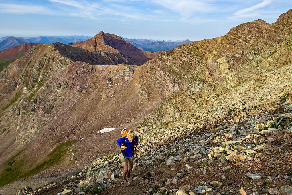 Me, nearing the top of those 2,800 Feet. Photo by my climbing partner Luis.
Topping Out On the Initial Suck
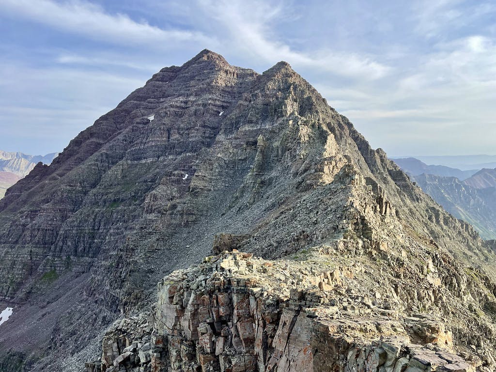
About 400 below the top of this "Suck", I either started to feel better or was motivated by how much we had gained in such a short amount of time. I'm not sure what turned things around for me, but the remainder of this section went by far easier than the first half had. And then suddenly: you have your first close-up view of the final objective.
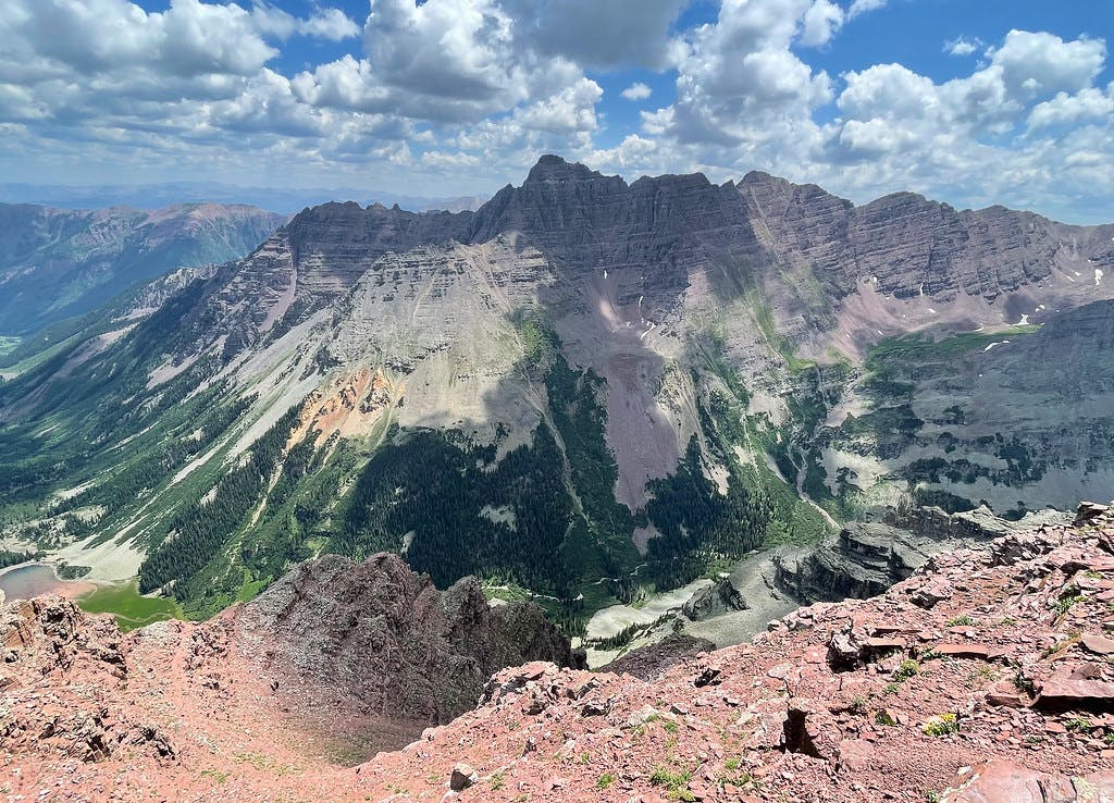
 You get your first look at Maroon’s summit after topping out on the “2,800 feet of suck”.
At this point, we took a quick break to get ready for the climbing ahead. Helmets on, hip pocket snacks refreshed, and we were ready to go. As we began the ridge walk my excitement for the route ahead grew. Now we were getting into the good stuff.
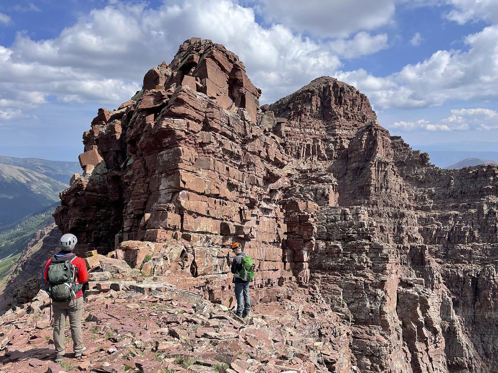
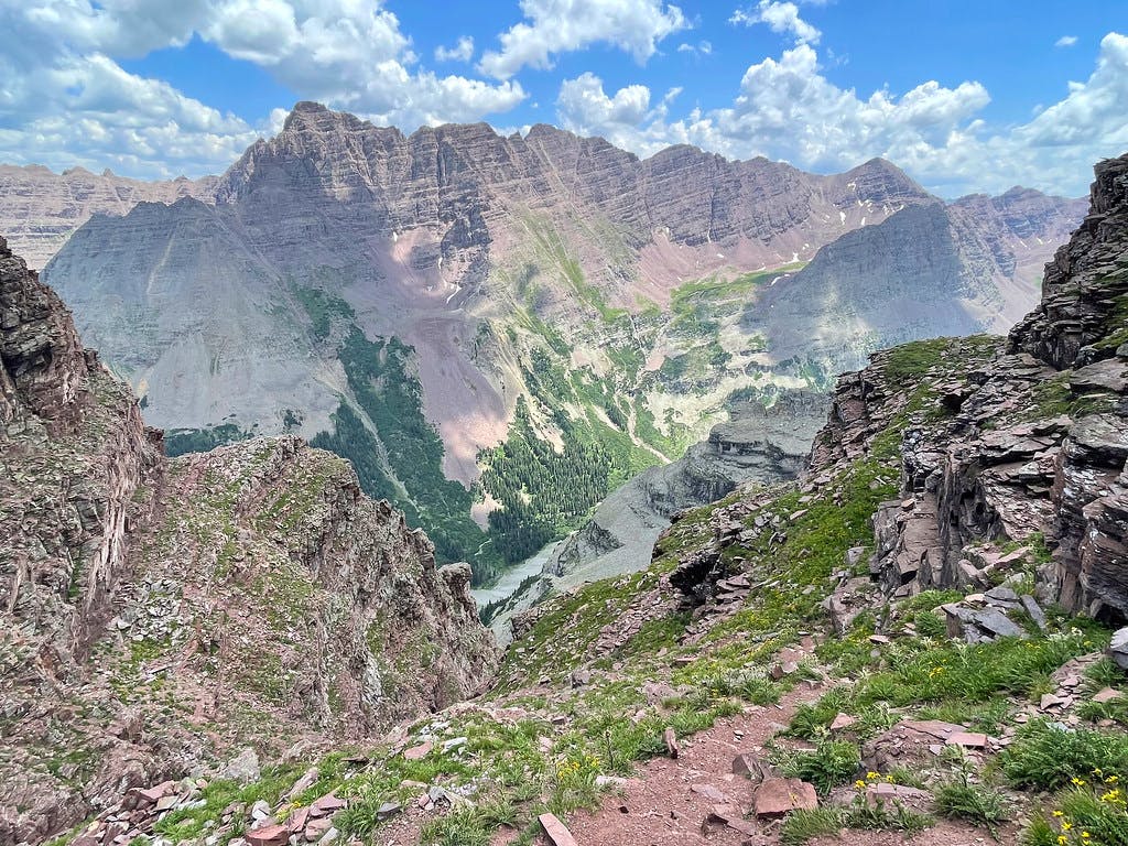
 A closer, head-on view of the remaining route.
After snaking over this ridge line, you meet your first technical objective: a vertical chimney about 20 feet tall that tops out underneath a rock band. This chimney is easily gained and the scrambling felt solid. As I navigated this chute I thought about how there were a handful of objectives over the next 3/4 mile between ourselves and the summit of Maroon Peak. I found myself already mourning the end of our climb. Premature, for sure, but this is also what led me to consider extending our day.
Beginning the Technical Climb
"How much of the traverse have you looked at?" I shouted over to Luis as we carefully rock-hopped around Maroon Peak's southern shoulder. I was curious if he had the same idea I did.
"Why do you ask?" Luis replied, almost daring me to just say it.
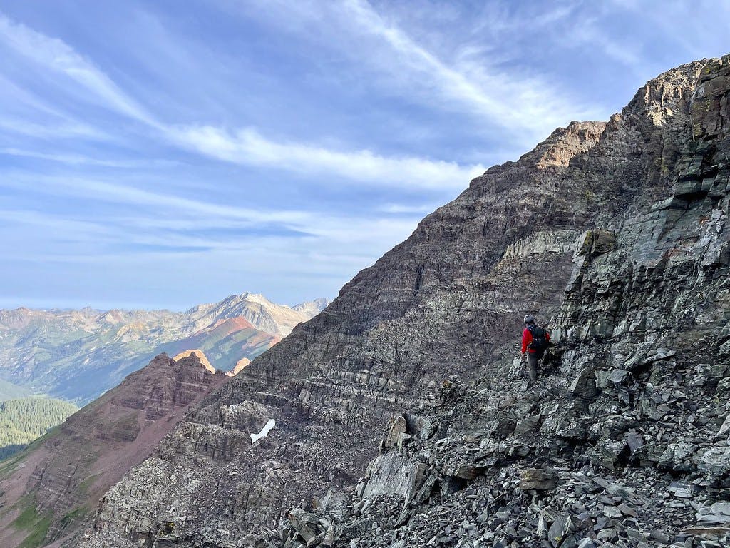 Hugging Maroon’s southwest shoulder after ascending the first chimney.
"I don't know, it looks like we might have a perfect window if we wanted to go for it." I looked up at the sky. There were a handful of fluffy clouds in sight but otherwise, it did look like we would have a clear morning and early afternoon. Plenty of a buffer if we wanted to spice up our day.
I knew I had North Maroon's descent route downloaded to my phone, as well as the route images from 14ers.com and someone's track from a climb of the same route a week prior. I felt a little better about this decision and the factors at play. We continued up.
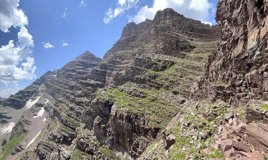
 A closer look at a well-marked section of Maroon Peak’s southwest ridge trail.
As we turned a corner on these ledges, we got a closer look at the two gullies that continue up Maroon. Jason was still ahead of us, navigating a loose and seemingly steep section of the far chute. We watched him kick some rocks down as he evaluated his line before opting to take the closer gully ourselves. It appeared to have supported bands instead of the loose scree he was pushing through.
Moving carefully and quickly, we were out of the gullies in 14 minutes. At the top of these gullies is a narrow trail that turns another corner to reveal a ~40-foot robot guardian towering over the trail. Here you can continue past him and to the right.
 This robot-shaped guardian lets you know you're near a turning point.
A 400-foot final scramble awaits you behind the robot. These are some of the steepest sections of this route, but without the drop-offs seen on the ledges earlier. Pushing up to the summit takes about a half hour from this point.
About 200 feet below the summit we finally caught up with Jason. He was doing alright but looked beat and maybe a little discouraged. He told us he had been looking for someone to partner on the traverse with as he didn't want to do it alone, but had never found that partner. We revealed that we had been considering the traverse and I think the decision was then made. We would all continue on together after summitting Maroon.
Summitting Maroon Peak
The last few hundred feet up Maroon Peak were straightforward but thrilling. No longer needing to use my hands, I quickly broke ahead of the group and rock-hopped my way towards the flat summit above. I was stoked we had come this far, but the excitement for our impending class 5+ climbing was really starting to build.
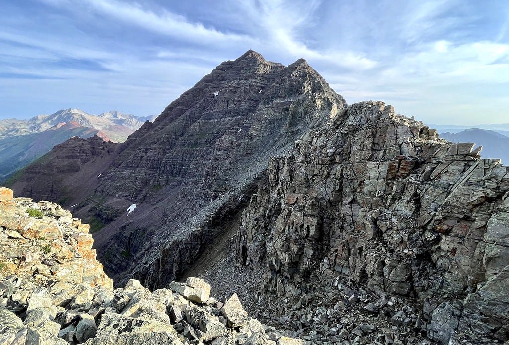
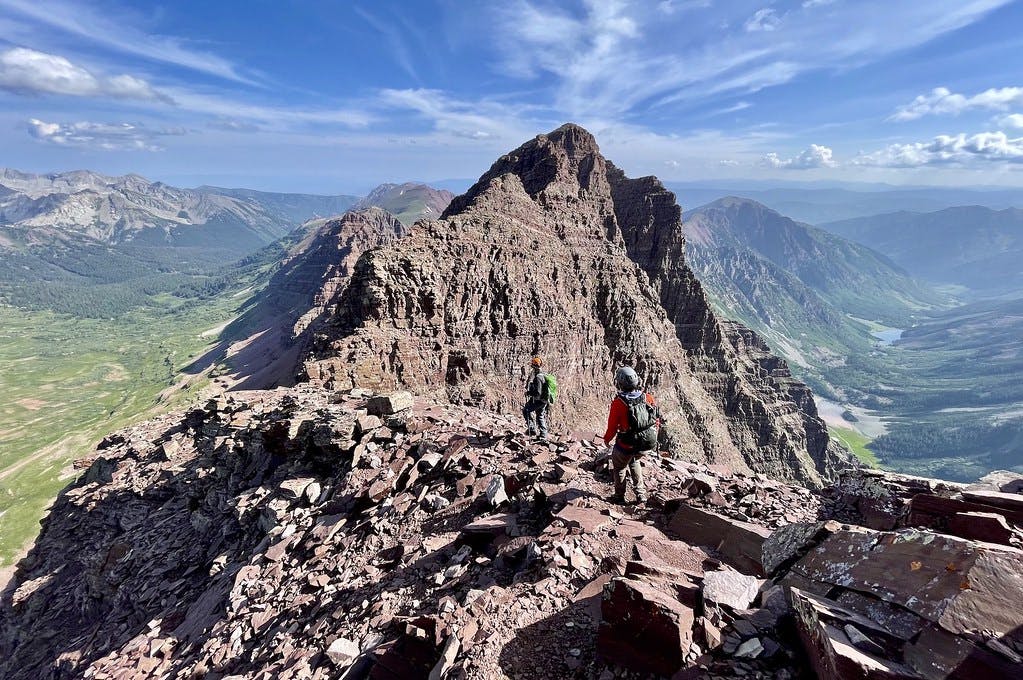
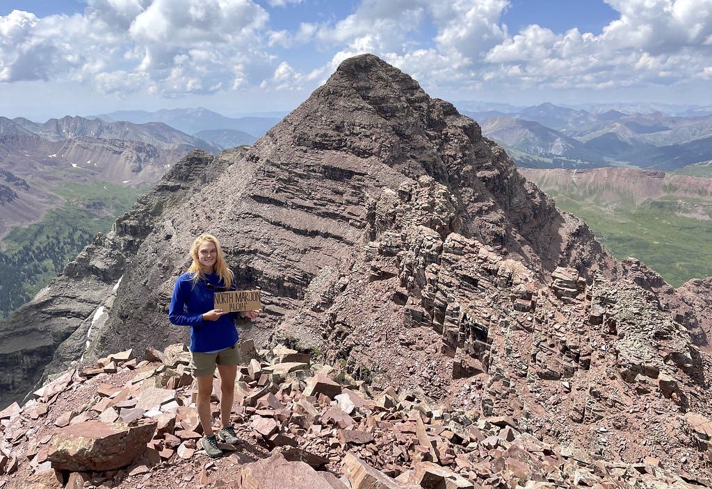
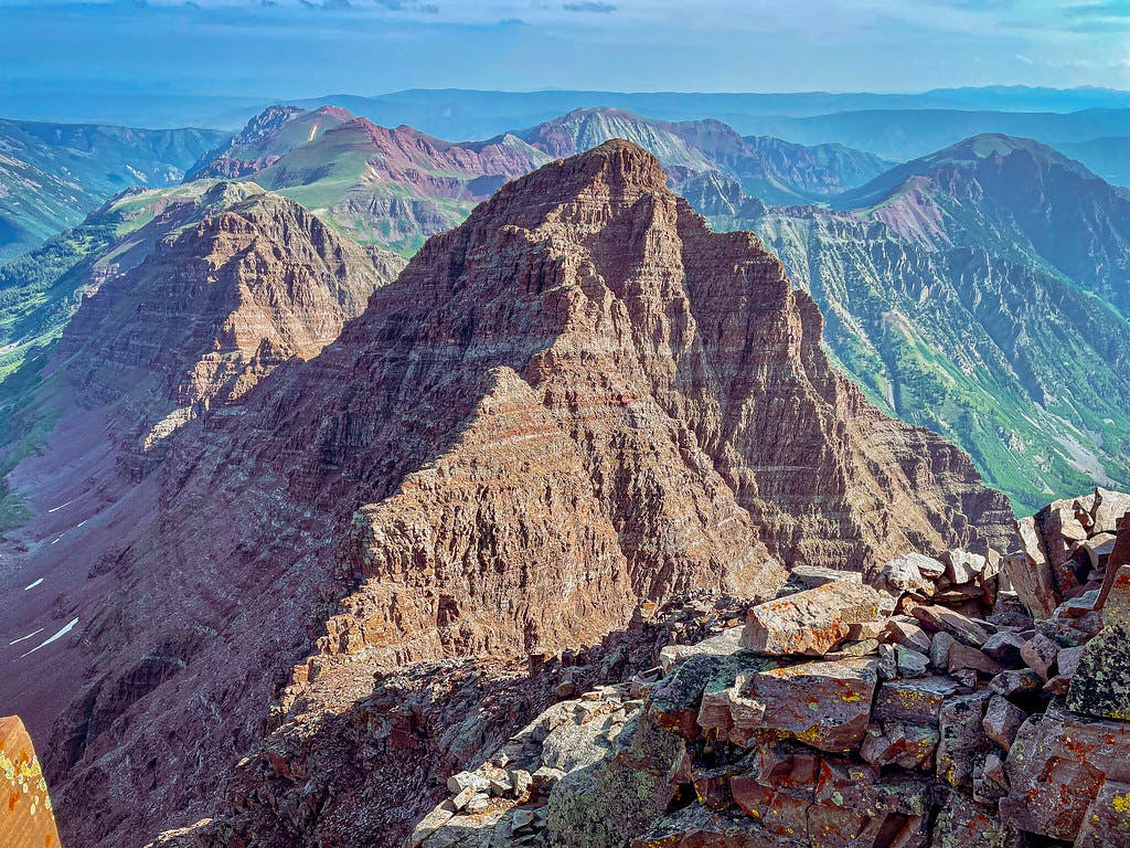 On top of Maroon Peak, looking at North Maroon and the traverse route.
Topping out was thrilling, and I was surprised to see the actual summit of Maroon Peak is quite long and flat. After a quick celebration and chat with a stranger already on the summit, we took a closer look at the traverse route. I called my emergency contact (my fiancé, Kyle) using the available cell reception to give him a heads up about the change of plan. He was honestly shocked to hear we (but especially I) were going for it as we had recently discussed whether it was reasonable to solo class 5+. Putting aside his initial concern, he wished us the best and said he would watch my Garmin track carefully. After a quick beat and pack check, we dropped off of Maroon's summit.
Beginning the Traverse
 Dropping off of Maroon Peak, beginning the Bells Traverse.
The initial drop off of Maroon Peak toward the Cord saddle is intimidating, and conditions don't quite improve as you continue down the slope. The rock is extremely loose and the abrupt cliff to your right almost draws you towards it, begging you to let your guard down. There's no easy way to describe the discomfort you feel realizing exactly what's at risk on this section of the traverse, but it's hard not to be hyper-aware of one's mortality as they manuever this incredibly steep and loose slope. At least you only need to endure a quarter mile of this.
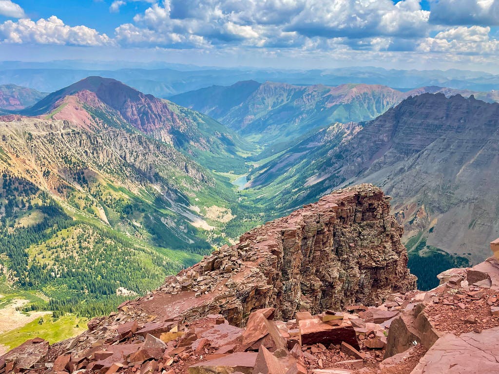
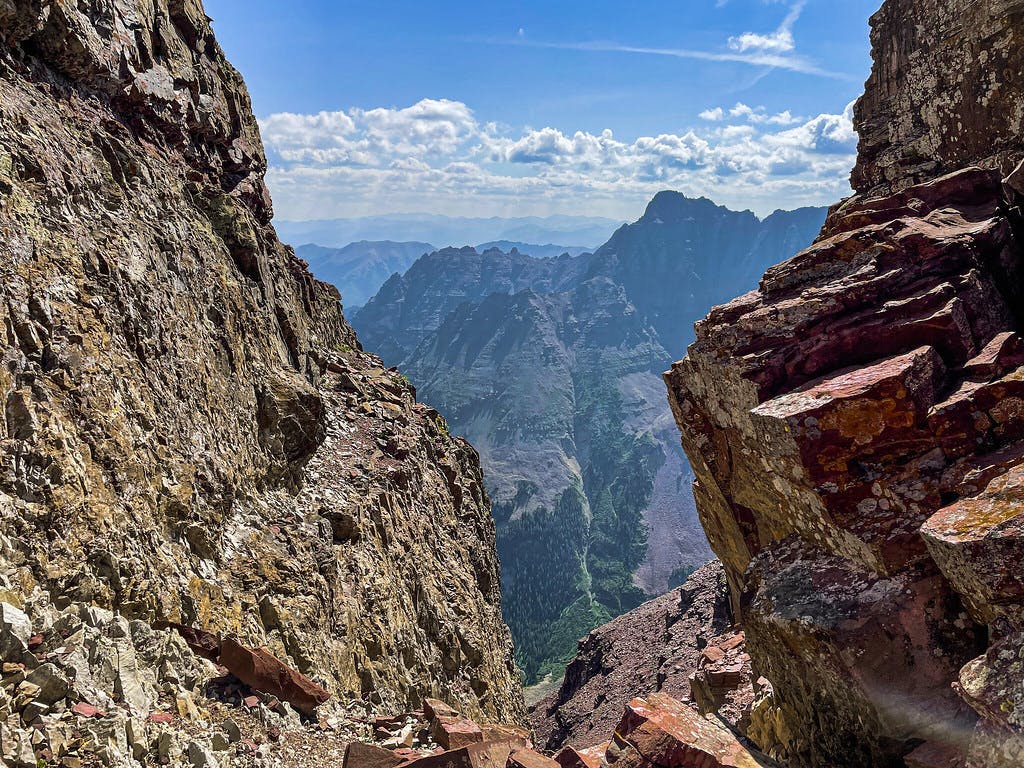 At the top of the Bell Cord Couloir, looking east to Pyramid Peak.
There is one final 20-30 foot pitch of rock to negotiate before you reach the proper saddle of these two peaks. This is the second significant test of your tolerance for exposure along the traverse, and the hazards only increase from here.
 Looking back at the last bit of Maroon's descent from across the Bell Cord. Zoom in to see our climbing partner Jason y down the 20 foot wall.
Once we crossed the top of the Bell Cord we began to gain North Maroon, a journey that would cover double the distance we had just dropped down (from 0.2 to 0.5 miles). Our first obstacle was a chimney up to a flat area where we would need to then assess some more technical terrain.
The views all day had been otherwordly, but at this point along the route they were especially incredible: Pyramid Peak standing at eye-level to your right, Capitol and Snowmass with their threatening ridges and surrounding lakes to your left.
 Looking north to Snowmass and Capitol Peaks from between the Maroon Bells.
Making Some Technical Decisions
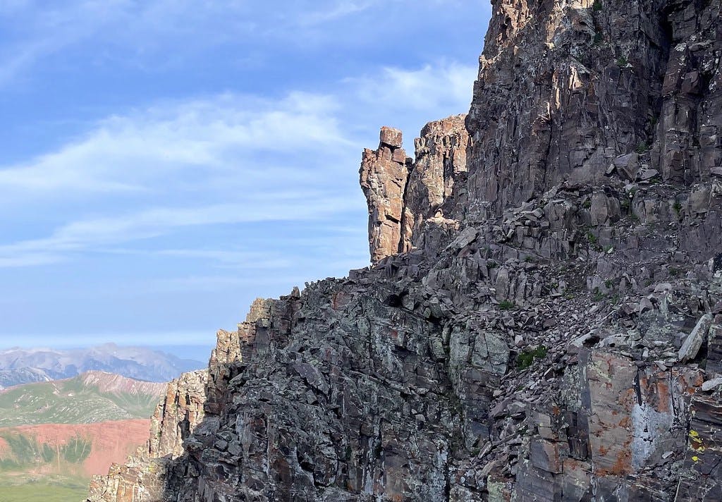
The toughest sections of this traverse are the three spires you'll need to navigate. The first is fairly easily climbed through a head-on 20-foot crack, but the second requires some extra attention.
There was an interesting ledge to the right of the second spire, but it didn't appear to connect to anything once it rounded the corner out of sight. From the vantage point where we assessed our available lines, it looked like there was less extreme exposure to the left. Upon further inspection, we each found a line we were interested in climbing. Luis's had an overhang, mine had shallow pockets but no overhang, and Jason's narrowed out into a chimney at the top. I'm still not sure which of us took the better line, but they all hugged the middle-to-left side of this spire.
 Looking for a line on the second spire.
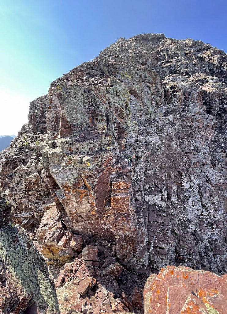
After topping out on the second spire, there is a nice flat ridge line to walk along before you approach the third and most significant challenge of this traverse. The third spire stands tall and confidently in your way, blocking the view of North Maroon while you assess your line. While the climbing to gain this spire's summit is fairly straightforward on solid holds, there is a point where you will need to mitigate an overhang near the top that will once again test your exposure limit.
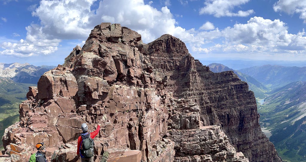 Comparing options for the third spire, North Maroon’s summit visible beyond this set of obstacles.
Topping out on this spire was especially rewarding, as the remaining sections of the climb begin to finally come into clear view. There was left over protection from someone's climb prior in a crack at the top of this third spire that made us all feel a little more accomplished having not used rope. Of course, going this direction is much easier without protection. If we had been traveling in the opposite direction, North to Maroon, each of these challenges would have been triple the difficulty in my opinion, I feel down-climbing is more more perilous than an up-climb.
Gaining Our Second Peak
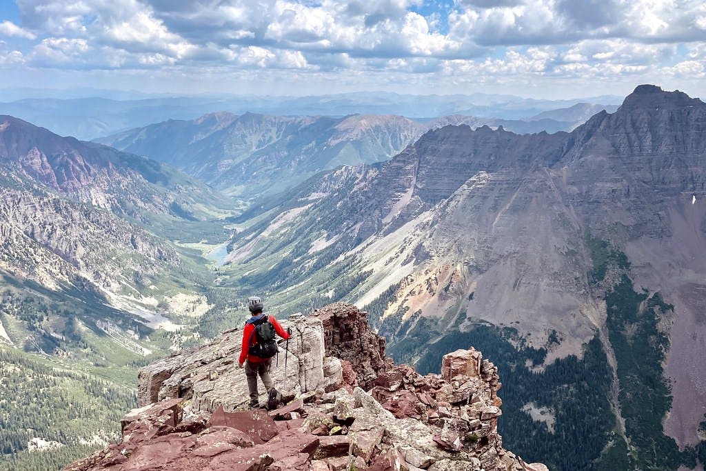
Snaking along a thin section of ridge, we paused to take in the view of the remaining route.
 Jason looking up at the remaining route to North Maroon from a gap crossing past the third spire.
All that was left between us and the summit was a continued snake along a ridge until you are dumped into a screefield with some larger ribs to the right. I once again felt the summit fever set in as I gained this final block and pushed until there was no more height to gain.
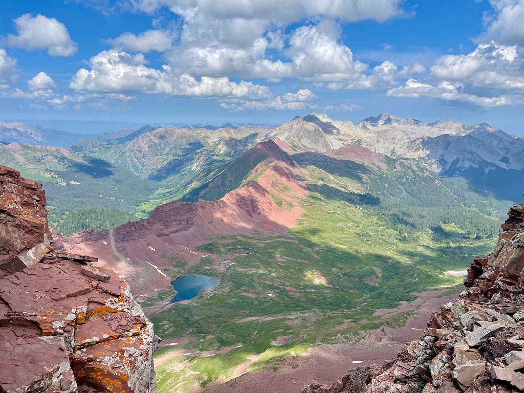
 The final push up to North Maroon’s summit, red ridgelines of the Four Loop Pass visible behind us.
Summitting North Maroon
It's incredibly difficult to describe the feeling I had standing on top of this summit. The feeling of accomplishment combined with the thrill of being able to see the craziness we had just navigated was unlike that I had felt on peaks prior.
 Standing on North Maroon’s summit with Maroon Peak and the route we just traversed in the background.
I could see people standing on top of Maroon Peak from where we stood and found myself wondering what their day had been like. What lines they had chosen up the Maroon gullies? Had they traveled here from near or far? Did they have plans to do other peaks in the area while they were here? None of this matters, but it was fun to consider their backgrounds and lives. They were only a half mile away from us point-to-point, but there would be no way for us to have a conversation with them up here. We all just existed around each other at 14k in that moment. And that's all it was.
A Class 4+ Descent
It's important to remember that after your second (or third, fourth) summit on any traverse, you still have to spend the rest of your day navigating brand new terrain. Even if you've taken the descent route before or studied photos of it ahead of time, conditions may have changed since the last report. A descent requires a different perspective than an ascent and most routes are written from the perspective of someone going up, not down. At various points along the trail off of North Maroon, I found myself second-guessing my choices and running our lines by the downloaded GPX and photos available on my phone.
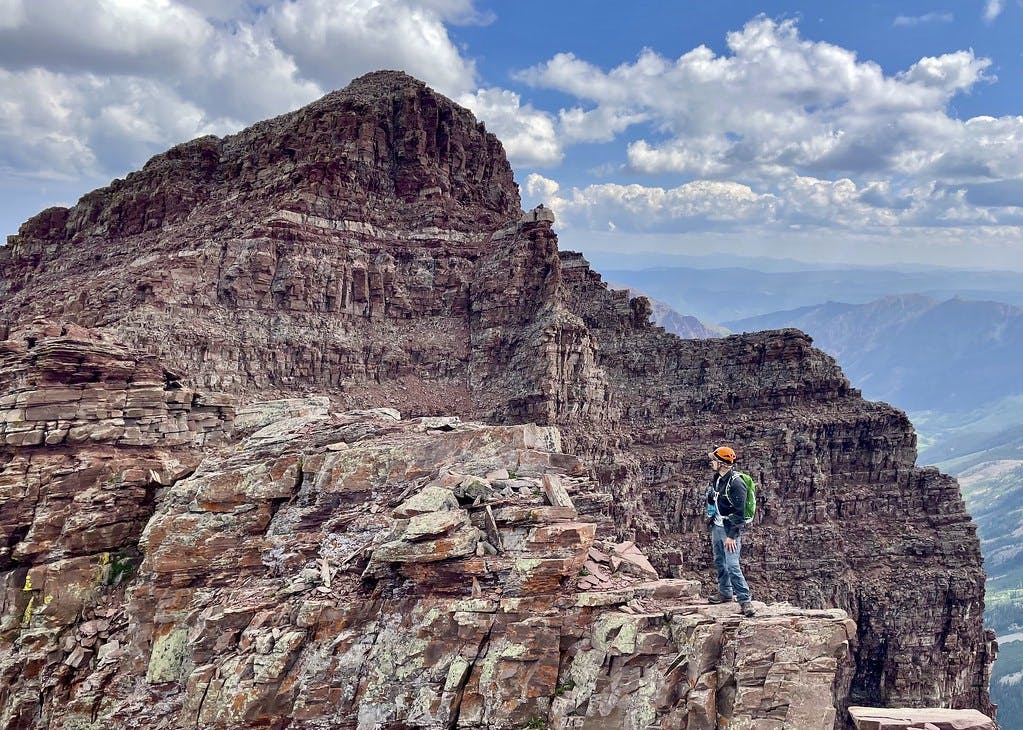
There is a point along the first few hundred feet of North Maroon's descent where hikers are forced to climb down a feature nicknamed 'The Precipice': a piece of rock that juts out and appears to abruptly drop off. There were cairns visible along this ridge, but it was still daunting to consider walking off of it having not gained that feature earlier the same day.
 A look at ‘The Precipice’, a feature we will need to walk off of.
As you walk off of this feature, it's easy to question everything you thought you knew about this route. What's past this drop? Is it going to be a steep cliff or is there at least going to be an obvious foothold? Can I trust these cairns? There sure are a lot of them...
 Luis walking off of The Precipice.
And then suddenly, you're passed it and onto the next obstacle. This was how most of the tough features came to pass.
The most difficult move along this route is just below The Precipice, around 13,680': a class 4 chimney directly down and through a rock band. There is a bypass available to the left (the right on your way up), but as has been the case on this descent, it's not very apparent what's below you until you're on top of it. By the time we were on top of this chimney it seemed more worthwhile to attempt a down=climb than backtracking and locating the class 3 option.
I will say, this was the most nerve-wracking part of the day for me. I went second out of our group of three, and even though I watched one of my partners comfortably descend, I didn't feel confident about my own drop. There is a very flat ledge at the top that I chose to slide off of and hold onto. After dangling with my feet a few feet above the lower ledge, arms fully extended for a cool 30 seconds, I let go. It wasn't nearly as bad as I had expected, but it still got my heart rate going. Once all three of us had made it passed this, I felt I could finally appreciate the clear view we suddenly had of the lakes below.
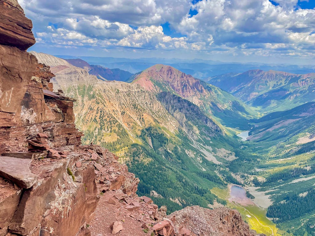 Looking out to Crater and further, Maroon Lake from around 13.6k’.
Endless Gullies
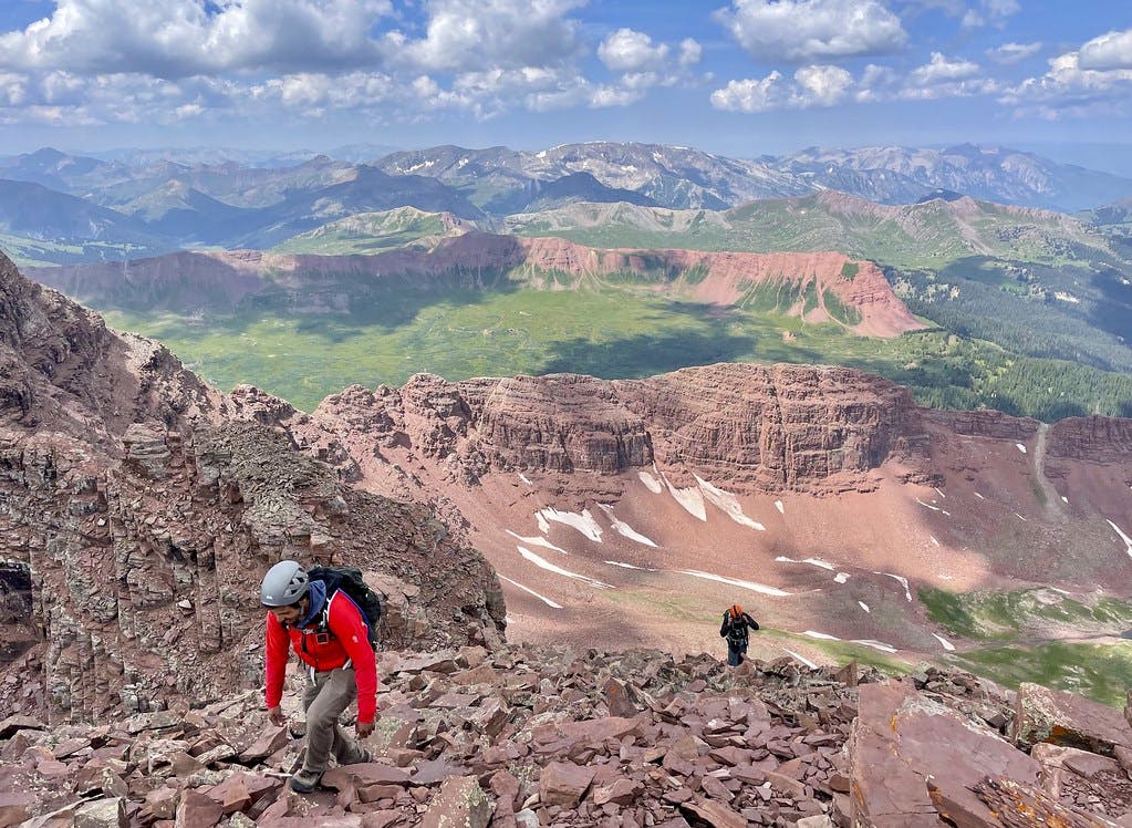
Now, the seemingly endless gullies begin. Standing at the top of the first (second if you were ascending) gully, it's not obvious which direction you're supposed to head. I once again referenced the previously downloaded information to identify our goal: a small bare spot along a rib visible to the lower far side of the gully we stood at the top of.
 Near the top of the first gully descending North Maroon with Pyramid Peak in view.
As we dropped into this gully, time felt like it nearly came to a stop. Our descent dragged on and we were all starting to feel it, almost entirely thanks to the tedious nature required to navigate this type of terrain. We tried not to kick rocks at each others' heads, shouting whenever something was dislodged. Spending so much time in your head considering the impact of each step and how much weight you should be applying to every inch of that loose rock is quite a bit more tiring than soloing a 40 foot vertical chimney, in my opinion. And then, every time you look up, the view has only barely changed.
 Continuing to descend North Maroon’s maze of gullies.
The rock was loose and the trail is not well defined. I'm not sure exactly how long it took us to navigate both of these gullies, but it felt like double the time we spent moving between the two peaks. There were no good spots to take a break, either, so the three of us just grumbled through it, still somehow excitedly discussing our dream routes and separate plans to return to 14k soon.
 At the bottom of North Maroon’s second gully, looking back towards the two peaks.
Finally reaching the bottom of the second gully and looking back was an incredible feeling. Seeing Maroon's shoulder behind North Maroon's pointy summit beyond this wall of loose rock inspired a feeling of pride. We had just achieved something I hadn't even considered feasible for myself the week prior.
We took some time to rest, evaluate the remaining route, and eat a snack. While the most difficult climbing might now be behind us, we still had some more tedious terrain to voyage before we would be back to a well-worn dirt path.
Perfect Timing
Standing at the bottom of the gully, we were all more wiped than I think any of us expected to be. Jason let us continue on without him as he had plans to meet his wife at their camp near Crater Lake and Luis had a night shift in the front range to rush back to. I got a little turned around trying to identify our descent route after the snack break, but after a couple of tight circles we located it and continued down. At the bottom of the gullies is a sharp corner marked by a couple of precariously rooted trees, and just beyond that corner is a long and seemingly never-ending talus field.
This rock slope was filled with human-sized boulders separated by dramatic, human-sized gaps. Every few gaps were gated with a thick spider web that I was unlucky enough to walk mouth-first into no less than three times.
After 32 slow minutes maneuvering this spider haven, we were grateful to be back down to the lush grassy fields of the lower Bells and making our way back to the Snowmass section of the heavily trafficked Four Pass Loop.
 Finally reaching grass at the end of a seemingly never-ending scree slope near the end of our descent of North Maroon, a storm visibly brewing.
After not seeing anyone but our new friend Jason and a stranger on the summit of Maroon Peak all day, it was jarring to be back among the crowds when we connected back with the main trails. It felt strange to suddenly be taking advantage of photo ops like Crater and Maroon Lakes after having spent so much of our day weighing harrowing lines and navigating difficult terrain. We were getting double takes from folks as we passed them with helmets strapped to our packs. We continued on at a quick pace, finding it easy to move quickly when the path was a well-packed dirt trail, and even quicker when the thunder and rain started. We were eager to get back to my car but more importantly, back to the snacks and ice-cold Gatorades we had each stashed in there.
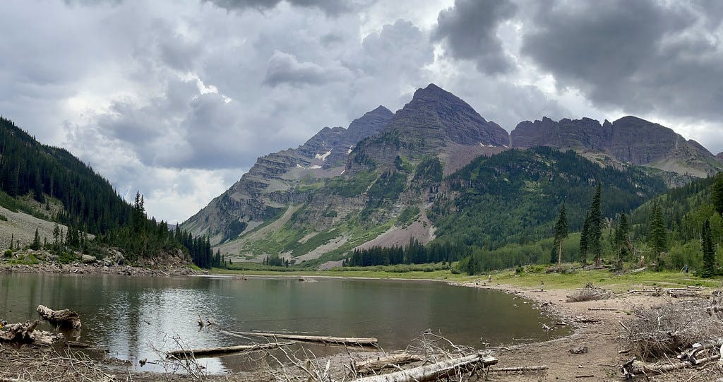 Looking back at Maroon and North Maroon from Crater Lake with storm clouds fully formed above them.
Swelling with pride at what we had accomplished, I rushed to get Luis back to his car in Georgetown so he could continue on to his overnight shift at work. It was a really good day.
Climb Stats
Tracked on Strava and AllTrails:
Date Climbed: Thursday July 31st, 2021
Distance: 12.6 miles
Elevation gain: 5,060 feet
Time: 12.2 hours
Difficulty: C4/C5
More information about this route can be found here.