Solo Scrambling Above Herman Gulch
On a Thursday this past July, I decided to target a scramble near our home in Clear Creek county. Herman Gulch is known for its profusive wildflower season so it already seemed like a great time to go up that way, and the last hike I had been on in this area was in the middle of a snowstorm with visibility no further than 200 feet. I wanted to see what the basin looked like on a clear day but also get a mild, lesser-traveled climb in.
Comparing routes in the area, The Citadel stood out as a solid option because it had class 4 variations I could opt for. Pettingell or Bard Peak, other 13ers accessible from this area, are only class 2 from this side.
Heading Up
The approach to this climb is an easy and popular day hike up Herman Gulch. At the top of the gulch, there's a large, shallow lake underneath the 13,553-foot Pettingell Peak where folks often stop for a mid-hike break. This is where you begin the variation to get up to the Citadel's southern shoulder.
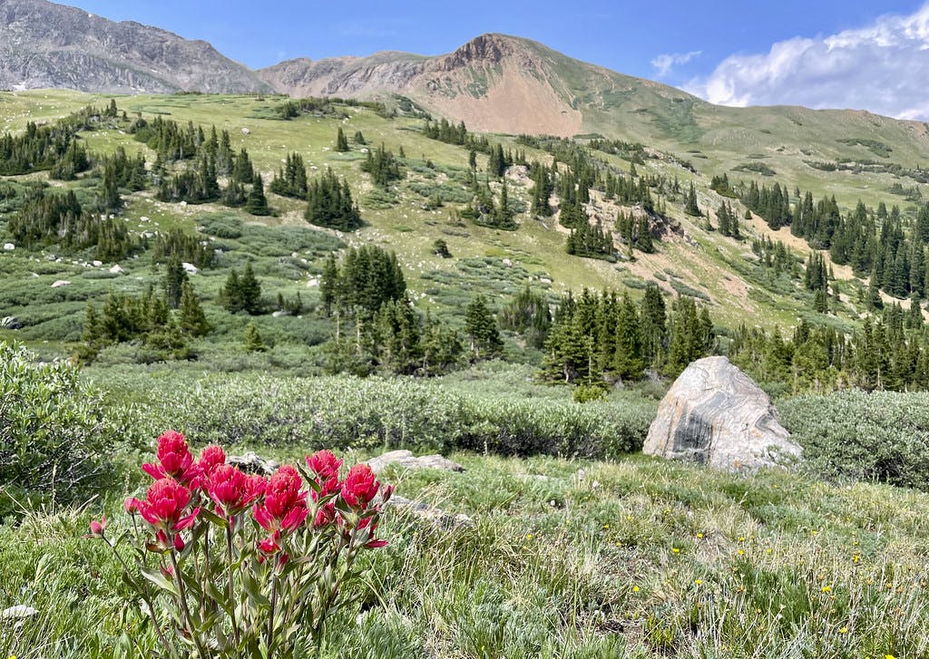
There are wildflowers aplenty if you're hiking this in the early summer. Late June through mid-July is considered the peak season to see these flowers, but it can vary year to year. Being such a lush valley, you can find yourself among some large crowds if you choose to hike it on a weekend during this time of year.
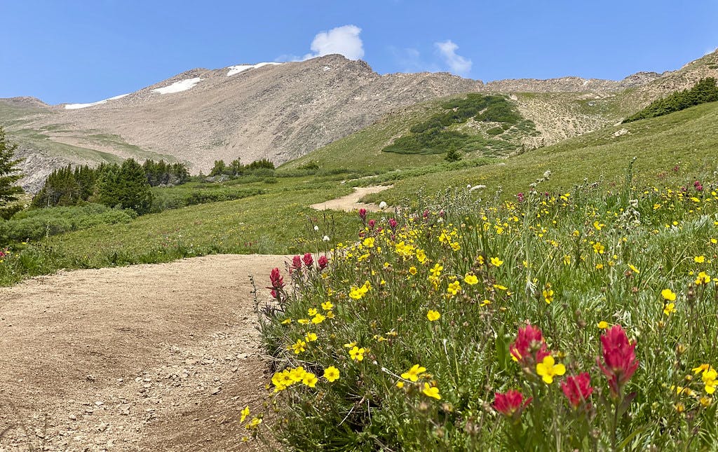 Wildflowers seen along the standard route up Herman Gulch.
After turning left at the lake and heading up a narrow trail to a marshy area, you'll lose sight of cairns. As is the case with many 13ers, there's another path visible gaining the shoulder that I chose to cut the edge of the marsh to get to, but I'm sure there are alternatives that will take you directly to this path. For what it's worth, I did try to target that trail on my descent but did not find any well-traveled or marked connection back to the main path. You will need to bushwhack a little bit to get to this peak.
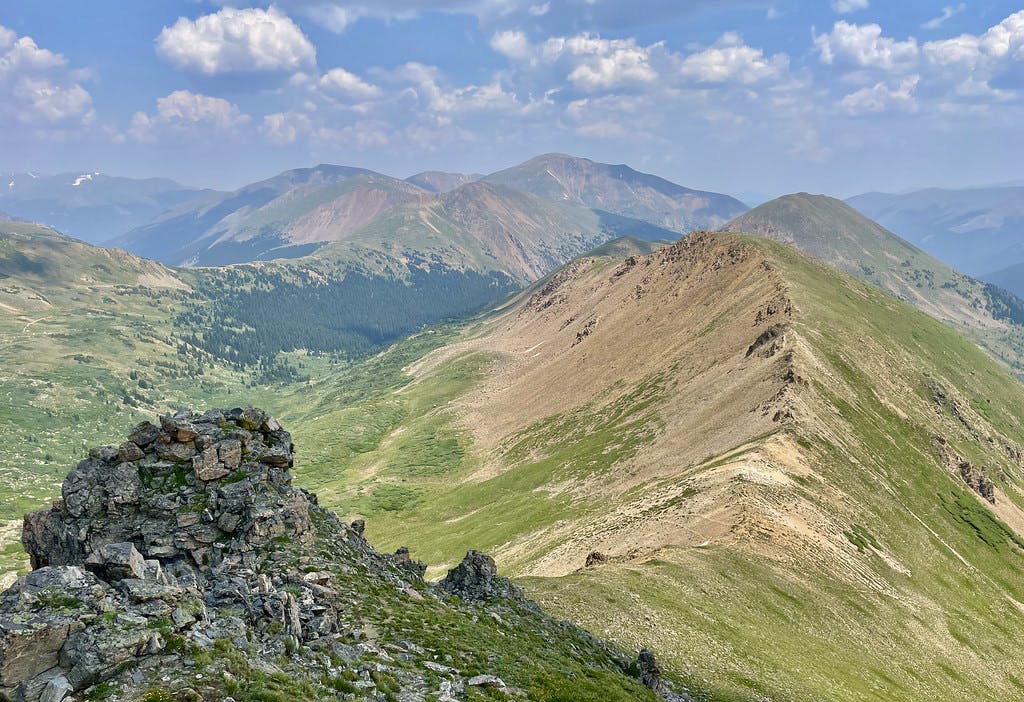 Looking out towards Mount Bethel after leaving the basin to gain The Citadel's southern shoulder.
Once you gain the saddle between Hagar and The Citadel, Golden Bear and a section of the CDT come into view. The ridgeline connecting the two unofficially named peaks ("The Citadel" and "Golden Bear") looks daunting but doable. I made a mental note to come back here someday to see how doable it actually is.
Beginning the Climb
After switching up the ridge through some steeper terrain, I finally got a good look at the climbing ahead.
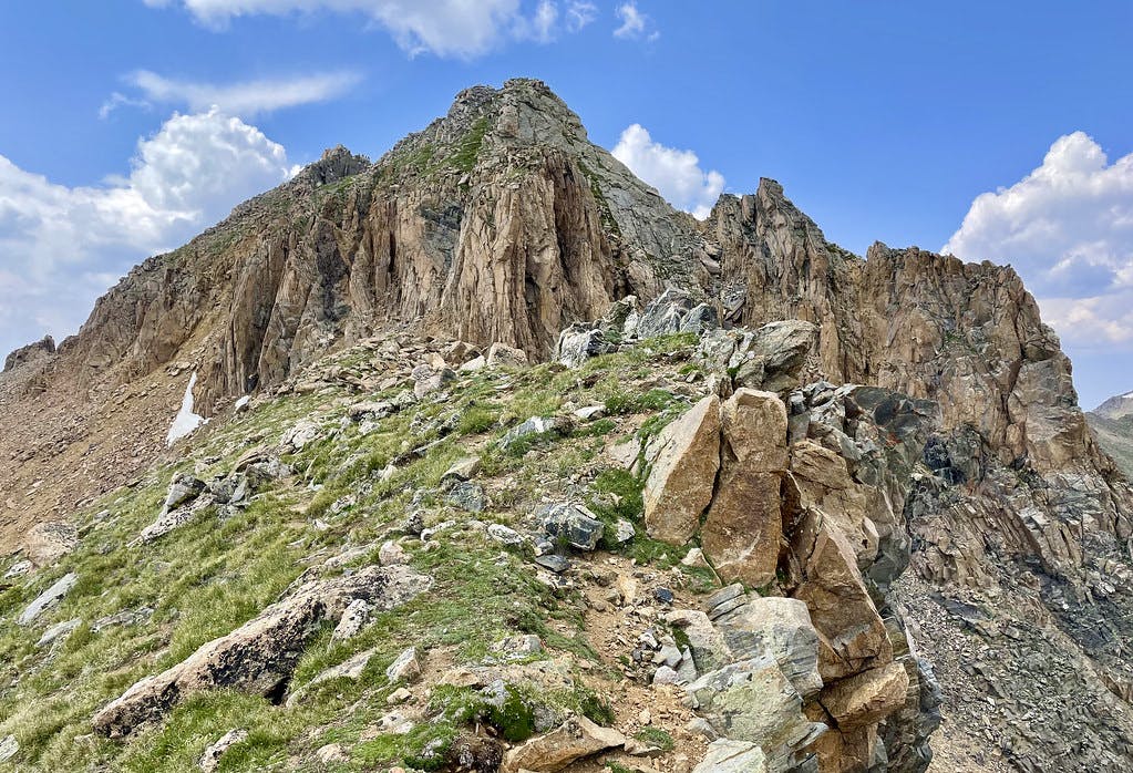 Evaluating options to ascend: gully (C3) is to the left, chutes (C4+) to the right.
At this point I chose to put my helmet on and stash my poles so they wouldn't get in the way of my ascent. I knew there was a vertical class 4+ (debatably class 5, some folks recommended rope) chute to the right that I wanted to try. Upon closer inspection, it looked solid and I felt confident going for this 30 foot wall alone.
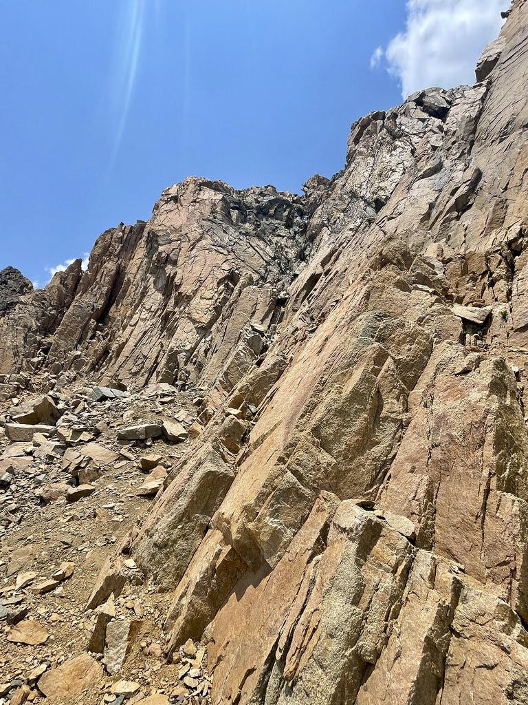 Looking up the chute I chose to climb, visible as a crack on the far right.
Admittedly I did hit my helmet once on a roof moving through the zig-zagged crack, but my helmet held up just fine. While I did feel forced to consider my mortality for a quick moment, I didn't feel too rattled so I continued up after a beat.
Topping Out
Moving up this wall was the highlight of my day, and when I topped out after 10 minutes I felt giddy. I had done some class 4 peaks in the weeks leading up to this, but none of those were solo. This was my first time scrambling anything above class 3 alone and I was proud of what I had done!
Looking back, I saw a leftover rope and anchor from someone's climb prior.
 Blue rope and an anchor is visible closer to the bottom of this photo, the chute I've just climbed to the right. Grays and Torreys on the horizon.
This was a humbling sight and brought back the reality that I was only halfway done with my day at this point. Sure, I had gained the chute just fine, but I still had to get back down and although I was hopeful the class 3 gully would be a viable descent option, I still hadn't seen it firsthand.
The first high point I gained initially seemed like the summit and even had a summit registry, but was only 13,108' at its highest. The true summit was still maybe a quarter mile and gully away. I took a break on this first high point, read the registry (found out it had only been placed in 2018), and had a snack before continuing on to the 13,294' summit.
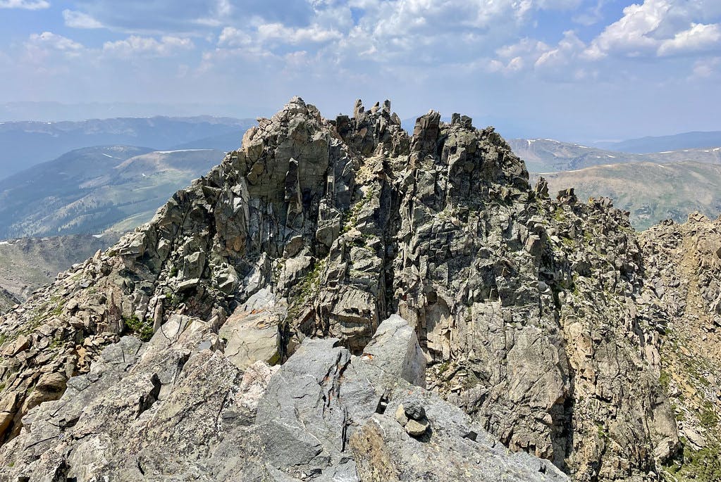 Standing on the initial false summit of The Citadel, looking over to the real summit block.
Traversing between these two points took me only 6 minutes according to my GPX track, shorter than it felt. Leaving the first high point was a bit of a loose scramble down to a rocky, scree-filled saddle. I had to jump down maybe 8 feet to actually get to the saddle after down-climbing a set of ledges, and I started to lose confidence in my ability to navigate the gully I knew was on the other side of this second high point to get back to the c2 descent.
Gaining the second summit was easier than descending the first. The summit itself was a set of toothy rocks, all about 6-8 feet tall. One can scramble up to the top of these teeth if you're up for a challenge, which I did.
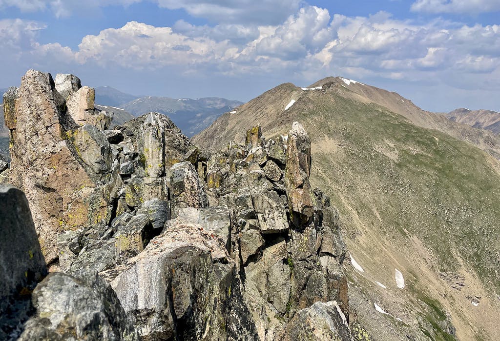 Standing on Citadel’s true summit, looking over to Pettingell.
The views of the surrounding peaks from this summit is expansive and the first high point I had come over looked like a single, sharp tooth from the higher angle. The sharp lines contrasted with wide basins makes this summit feel more like an Elk peak than a Front range one.
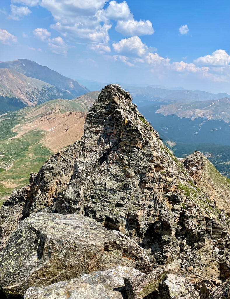 Looking back to the first high point from Citadel's true summit.
Descending the gully to The Citadel's west was as loose and unsupported as I had expected. I carefully planned my line and moved slowly on the way down, but still managed to kick some rocks free. This was where I managed to bruise myself the most all day, it's easy to kick medium sized rocks into your feet on this side of the mountain. Finally returning to solid ground after 22 minutes of cautious navigation was a big relief.
Bushwhacking Out
Getting back down the shoulder was simple and I still hadn't seen a soul above this ridge. I wouldn't see anyone else until I linked back up with Herman Gulch's main trail. Getting back to the main trail, however, was a bushwhack and a half, with the occasional misstep into deep wetland. I kept my impact on the land at the forefront of my mind as I tried to avoid stepping on any fragile land, plants, or animals.
 Bushwhacking through the a wildflower-filled field to return to the main Herman Gulch trail.
There are two river crossings worth noting but no real trail to follow. The second and largest river crossing was about a half mile from the main trail connection and from there was an easy 46 minute walk out to the lot.
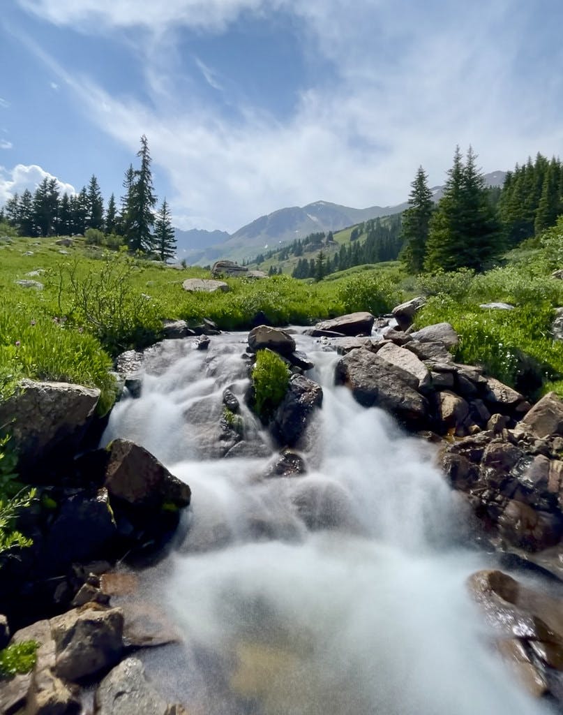 One of the two river crossings required to get back to the main trail. This one had a stable rock path through even though it was rushing.
All-in-all, this was a very rewarding solo hike. Doing it as a loop extended the solitary part of my day and I was grateful for the time to myself. The beautiful, wildflower-filled wilderness is the cherry on top of an excellent route. If you were looking for a mildly difficult and lesser traveled climb in the front range, I would recommend The Citadel's southern ridge. But it's important to note the level of experience required for an alpine scramble of this class (I would not do this alone if I had no or little experience scrambling c4 and above) and the impact individuals have on bushwhack trails. Traveling an unmarked trail through fragile wilderness should be done with caution and awareness, and groups larger than three can have a much larger impact on the terrain long-term. Please consider Leave No Trace principles before recreating in any wilderness area.
Climb Stats
Tracked on Strava and AllTrails:
Date Climbed: Thursday July 15th, 2021
Distance: 9.38 miles
Elevation gain: 2,874 feet
Time: 5.5 hours
Difficulty: C3+/C4
More information about this route can be found here.